
Aerial Inspection & Survey → 3D Thermal Modelling

3D thermal modelling of substations

A thermography survey tells you what is hot today. A 3D thermal model tells you whether the same joint was hot last year, and how much hotter it is now. We fly the substation energised, build a measurable 3D model of it, and map the thermal data onto that model — so every later survey lands on the same point, and a trend replaces a snapshot.
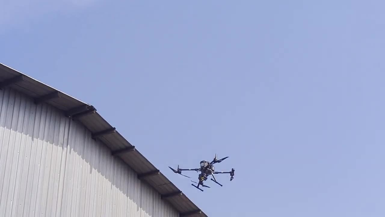
DJI Matrice 350 RTK with thermal payload in flight above an industrial roofline in Sri Lanka
Delivered on a 33 kV gantry and substationflown energised, under load
CAASL-registeredoperator and pilots
Certified thermographersLevel II and Level III, in-house
No outage, no one inside the fencethe yard stays live throughout

A survey or a model?

Both start with the same flight. The difference is what happens to the imagery afterwards — and whether the site will be flown again.

Aerial thermography survey

  • Radiometric images with each anomaly marked and rated
  • Each image is its own frame of reference
  • Right for a one-off inspection or a pre-insurance check
  • Costs less

3D thermal model

  • Imagery processed by photogrammetry into a measurable 3D model of the yard
  • Thermal data mapped onto the model — every finding has a fixed location
  • The next survey lands on the same point: point-to-point comparison, not photo-to-photo
  • Doubles as an as-built record — clearances and dimensions measurable from a desk
Delivered

A 33 kV gantry and substation, Horana

The 33 kV intake gantry and transformer yard at Piramal Glass's Horana plant, flown energised and under load. The imagery was built into a 3D thermal model as the baseline for future surveys; the plant's rooftop solar array was surveyed on the same visit.
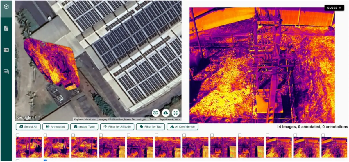
3D thermal model viewer for a 33 kV gantry and substation: the thermal map registered to the site on the left, a radiometric frame of the gantry on the right, and the 14 captured frames below
From the delivered model: the thermal map registered to its place on the site (left), one radiometric frame of the gantry (right), and the frames captured on the flight (below).

What you get

01

Baseline flight and model

The substation flown under load by a CAASL-registered pilot, radiometric thermal and visual capture, processed into the 3D model. Every anomaly located and rated by a certified thermographer.

02

Repeat surveys

Flown at the interval recommended for the asset after the baseline. Each lands on the same model.

03

Trend report

What changed since the baseline: new anomalies, ones that have worsened, ones that were repaired and are now clear. Ranked, with recommended action.

04

The model itself

The 3D thermal model of the yard, for your own records between surveys.
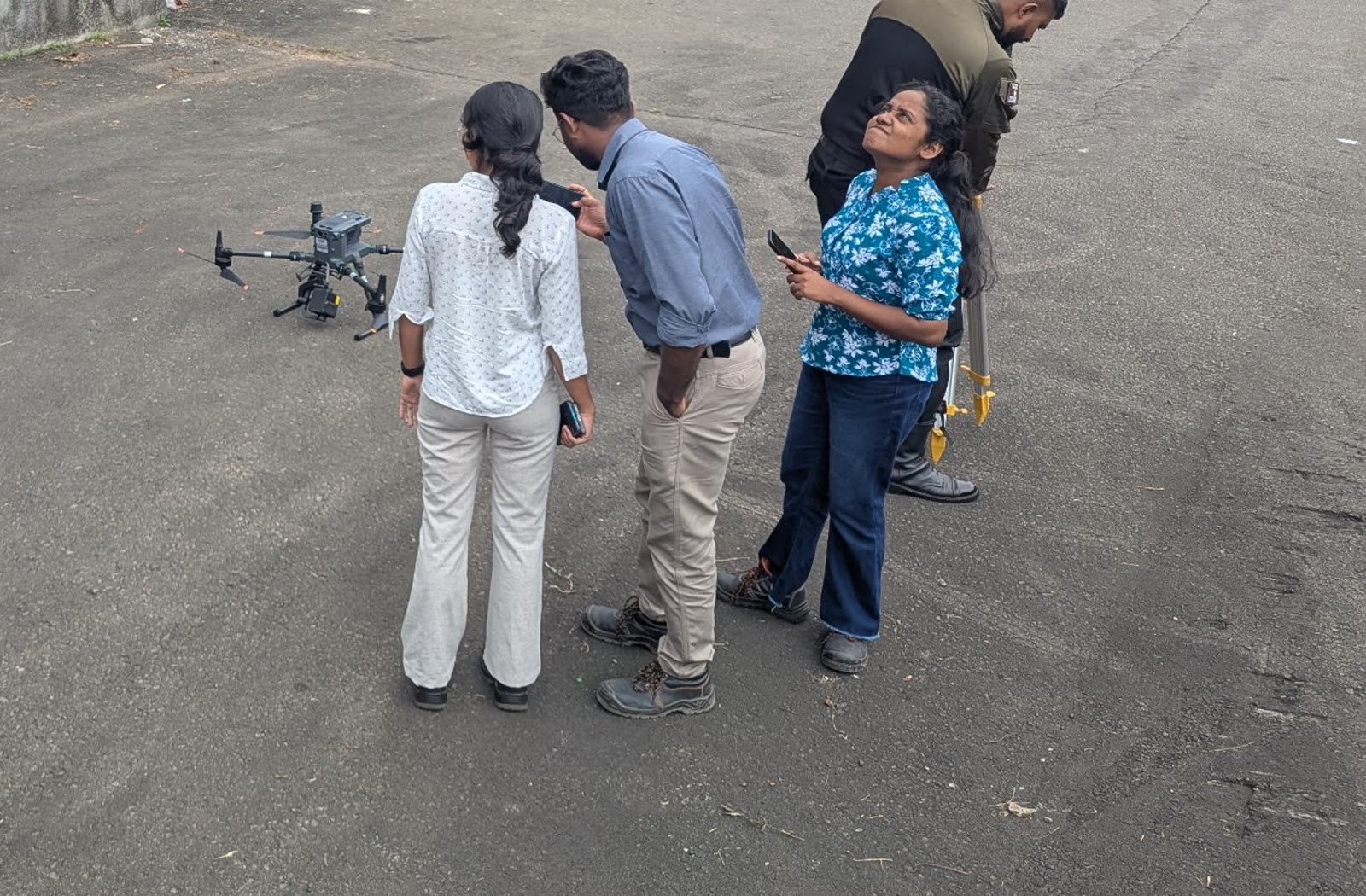
Vibhawa pilot and certified thermographers with the DJI Matrice 350 RTK before a survey flight
Pilot and thermographers fly together — the same team that inspects substations from the ground.
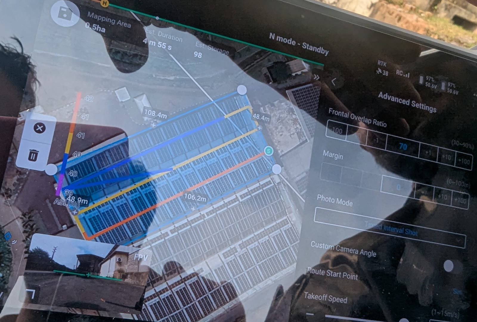
Automated mapping mission planned on the drone controller, with overlap and altitude settings
The mapping mission is planned for overlap and altitude, so the photogrammetry has what it needs.
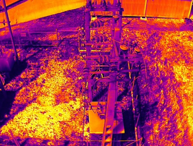
Aerial radiometric thermal image of an energised 33 kV gantry and transformer yard
A radiometric frame of the energised 33 kV gantry, one of the inputs to the model.

Who it is for

Owners of substations that will be surveyed again — utilities and industrial sites with 11 kV to 33 kV yards, generation sites with a switchyard, and estates with several substations where one consistent record is worth more than separate surveys. A trend is an argument for the maintenance budget; a single hot image is an opinion.

For a one-off check before a sale or an insurance renewal, a standard aerial thermography survey is the right service, and costs less. We will tell you which one you need.

Frequently asked

Open a question to read the answer.

Has 3D thermal modelling been delivered on a real site?

Yes — the 33 kV gantry and transformer yard of a glass manufacturing plant at Horana, Sri Lanka, flown energised and modelled as the baseline for that site's ongoing monitoring.

How is it different from a drone thermography survey?

A survey gives you thermal images with the anomalies marked, at one point in time. A 3D thermal model gives you a measurable model of the site with the thermal data mapped onto it, so every later survey compares to the same location. Choose the survey for a one-off inspection; choose the model when the site will be surveyed again.

How often are repeat surveys needed?

It depends on the asset, its loading and how fast change is expected. We recommend an interval for your site after the baseline survey, rather than apply a generic one; a site with known problems is flown more often.

Do you need to switch anything off?

No. The yard is flown energised and under load — a de-energised busbar has nothing to show. The flight plan keeps clearance from live equipment, and nobody enters the fence.

What aircraft do you fly?

The DJI Matrice 350 RTK with a radiometric thermal payload, and the DJI Matrice 4T. Both are registered with the Civil Aviation Authority of Sri Lanka and flown by CAASL-registered pilots.

Can it be used on assets other than substations?

The method suits any large, fixed asset where thermal condition matters and the site will be surveyed repeatedly — switchyards, solar farms, transmission structures and process plant. Substations are where we have delivered it; ask about anything else.

Is your substation going to be surveyed again?

Tell us the site, the voltage and roughly how large the yard is. We will say whether a model is worth building on the next flight, or a survey is enough.

Request a quote

At Vibhawa, we offer state-of-the-art Electrical Consultancy, Testing, Condition Monitoring and Engineering Services designed for the needs of tomorrow’s world.

Services

Electrical Testing

Infrared Thermography

Electrical Consultancy

Electrical Design

Compliance Monitoring

Other Services

Recent news

  • All Post
  • Blog
  • News & Insights
  • work

© 2025 Vibhawa Consultants. Site By Remnis Global

Scroll to Top